Monday, July 31, 2006

July 30th, El Malpais National Monument


Sunday, July 30, 2006
Day 35
El Malpais National Monument

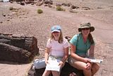
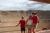
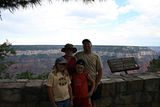
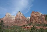
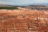
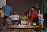
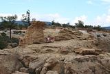
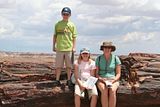
Photo 1 is us at the Sandstone Bluffs
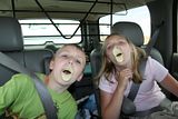
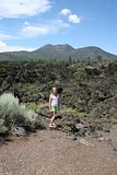
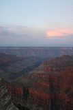
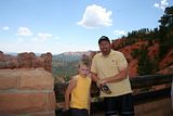
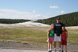
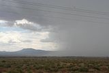
Photo 2 is the storm blowing in
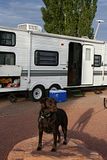
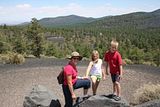
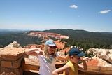
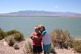
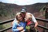
Photo 3 is us at the Bandera Crater
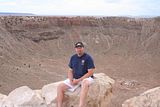
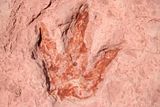
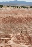
Photo 4 is us at the Ice Cave

OK, so if you are like me you have no idea what El Malpais National Monument is, or where it is, or what it means. You also have no idea how to pronounce it. Well, it is here just outside of Grants, NM. It is pronounced ell-mal-pie-EES. It is basically an area of land that is protected because it has a lot of interesting volcanic areas, especially lava tubes, and there are ancient petroglyphs here too. The work means “badlands”, and I think that refers to the fact that there is aa (ah-ah) all over the place here which is really rough lava rock that hardened on the top as the molten lava underneath continued to flow within the lava tube.

We drove to Bandera Crater and Ice Caves within the monument, but privately owned and operated. That cost us $26.00, but it was very interesting. You walk down to an ice cave, that really isn’t a cave at all, but part of a lava tube. The tube has partially collapsed, exposing this “cave” area. The bottom is filled with ice over 20 feet thick. The temperature remains a constant 31 degrees Fahrenheit year-round, so the ice never melts. It has a green color due to an arctic algae that grows within it. It was amazing to walk down the stairs to it and feel the temperature drop from the mid-70’s to 31 degrees.

You then walk back and walk up and around the volcano (Bandera) to the crater at the top. It is a big uphill climb to over 8000 feet of elevation, so I was huffing and puffing. My blood is not used to these high elevations! Coming down was easy though… Anyway you get to see the crater itself and it is quite deep, deeper than the Meteor Crater that we saw, but not as wide. I don’t have the pamphlet in front of me, so I’m not sure, but I believe it was around 700 feet deep and like 1400 feet in diameter. You also see where the lava tube begins, where it flowed out the side of the volcano. This lava tube is said to be over 17 miles long, much of it is collapsed now, but still QUITE long.

We stopped at the El Malpais Visitors’ Center and got some maps and the kids got their Passports stamped. They have run out of room in both the Rocky Mountain and the Western Section. We have just been to too many places. Their “additional” pages are now pretty much used up too. Time to move on to a different area of the country!

We had lunch at a diner-type restaurant right off Old Route 66, and I had phenomenal tomato soup. Really good! With a grilled cheese sandwich, yummy! After lunch we drove to the other part of El Malpais and looked at the Natural Arch, the biggest one in New Mexico. We also drove the dirt road to the Sandstone Bluffs. Those were cool and we hiked and climbed around on them. There was only one other person there. The children did good Junior Ranger deeds by picking up a couple pieces of trash while we were hiking around. Too bad it was a rainy day and it kept thundering. We had to leave because of the thunderstorm approaching. Brianna says she likes “rock climbing” and we would have liked to have explored that area a bit more. I’ll try to attach photos of this area at the top.

So, even though New Mexico is desert country, it has rained here a lot since we’ve been here. It also has been cool. I suppose it is the rainy season, but the storms are WEIRD! It’s not like it just rains all day non-stop, but you can literally see where the rain is occurring and it is heavy dark looking rain. If you drive into it, SLOW down! Then it will pass or you’ll drive out of it. It may be raining where you are, and 400 yards away it is dry. We also took a photo of a rain storm today, that we could see from the road. It looks out toward the highway (I-40) and you can clearly see where the rain begins. I’ll try to put that in at the top too.
Sunday, July 30, 2006

July 29th, Petrified Forest


Saturday, July 29th, 2006
Day 34
Drive through Petrified Forest National Park

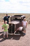
These photos are in "reverse" order too. The bottom one is before we left the RV park at Meteor Crater. The top one is Old Route 66 within the Petrified Forest boundaries. You can see the now defunct old electric poles that don't have any wires. I-40 is in the background.

Today was a beautiful day of driving and observing. We had a nice cool morning in Arizona, and after a morning of reading, coffee, and a little laundry, we packed up and drove across the parking lot to Old Route 66. Yes, historic Route 66 was right across the street from the RV park. This particular section is no longer in use, but we were able to drive down it maybe ¼ mile. Pretty neat! Rod even took a piece of roadway home with him!

Then we hooked up and drove to the Petrified Forest about an hour away. This park is one that is designed to drive through, even if you are towing an RV. That was nice. We started on the South end of the park at the Visitor’s Center. It was incredible to see all the HUGE petrified trees everywhere. If you don’t know what petrified wood is, it is wood that was buried quickly in silt and muck underwater, and since there was little oxygen it didn’t decompose, but the silica in some of the layers of sediment above the wood slowly seeps into the wood and replaces the cellulose with silica. Later other minerals and crystals form, such as quartz, etc. So, the wood turns to stone and may have beautiful crystals in it. You can still tell it was a tree, because of the shape and texture.

We had some awesome views of the Painted Desert while inside the park. We bought some souvenirs and had lunch at the North end of the park. The kids completed their Junior Ranger booklets very quickly, since this parks’ was easy! So, they got yet another badge. They really have quite a collection going. I also bought them each a little booklet to keep those pennies that you “create” in those penny souvenir machines. They have been collecting them, so now they have someplace to keep them.

The Painted Desert really looks like someone painted it! There are so many colors, and the way they blend is incredible. I haven’t looked at the photos from here yet, so hopefully I’ll have some good ones to post.

After lunch I drove the rest of the 100 or so miles to Grants, New Mexico. We are back on Mountain Time (Daylight Savings Time) and only 2 hours behind the folks at home. Tomorrow we plan on going to El Malpais (el mal pie is) to see some unique sights including lava tubes and other volcanic stuff, and a natural arch. We might go see an “ice cave” which is really an old lava tube that is 31 degrees all year round and has a lot of ice in it. We also have to go to Wal-Mart to get groceries. We’re down to the nitty-gritty and had soup for dinner. At least it is cool here at the moment. It seems we are really missing a hazy hot and humid summer back in NY. (Glad to be missing it…)

I have to mention that out here, the weather and storms and clouds are much more interesting and dramatic than at home. And the rain only seems to last moments and it may be raining in one place and not raining 400 feet from there. It’s pretty wicked to see the clouds and storms forming miles away. Today we saw a huge cloud rising up over an 11,000+ foot mountain as we were driving on I-40. It was very interesting. If one had been up on the mountain there would have been fog and probably rain. You could actually see the cloud slanting up over the top and witness the vertical development occurring. COOL! OK, bye for now!

July 28th, Drive to Meteor Crater


Friday, July 28, 2006
Day 33
Drive to Meteor Crater Landmark

The photos above are in "REVERSE" order. The bottom one is the dinosaur track, so as you read look back at the photos in reverse. If you don't know, you can click on the photo and it will come up as a bigger photo.

Today we left the Grand Canyon. I was sad to go because it was just so beautiful there, but we had a great day! We drove from the North Rim past the Vermillion Cliffs and saw the Colorado River where people often begin river trips on the river. We saw Marble Canyon and Echo Cliffs and then headed South toward Flagstaff. We stopped at Dinosaur Tracks, a place that is owned and operated by the Navajo Indians. It was really neat to see dinosaur tracks and eggs and fossils in their natural setting, but so sad to see that this area is not being properly preserved for future study. People come in a actually steal the dinosaur tracks and the place is not well publicized at all. It just looks crummy and is not well-run, but it was still neat to see the area. I was sad that no one in the Navajo tribe has taken more initiative to spruce up the area. This could be a real money-maker.

We drove a little futher and came upon the Sunset Crater Volcano National Monument. We stopped at the Visitor’s Center and the kids stamped their Passports. This is the first volcano I have ever seen and it was really cool. It erupted in about 1064 and it is just amazing to see the cinders and rugged looking igneous rocks everywhere. The cinders look like black snow on a mountain. It looked like a black ski run on the hillside. We drove to two turnouts to see the valley and the side of the volcano, and then we turned around and continued our trip to Meteor Crater.

The RV park here at Meteor Crater is very nice and it felt great to take a shower. We did not use the showers at the Grand Canyon because they cost $1.50 for 5 minutes. Here they are free. I would definitely recommend this RV park, it is very reasonable and the bathrooms are very nice. Anyway, we had to unhook to drive the 6 miles up the road to Meteor Crater, also known as Barringer’s Crater after its discoverer. The man who discovered this Crater in 1903 or 1906 (I forget) bought the rights to it back then and it has been owned by his family ever since. It is well managed and maintained, but expensive to get into. It cost us $40.00 to get in. That is almost as much as it will cost us to go to every National Park, since we purchased the National Park Pass for $50.00. But, it was very interesting. There is a museum there and they show a 10 minute film about the crater. Astronauts trained here for the moon landings! The crater is HUGE, but it is hard to tell that until you actually start looking at things that you know the size of. It is about 2.4 miles in circumference and ¾ of a mile in diameter. It’s about 550 feet deep which would hold a 60 story building. 20 football fields would fit inside the crater.

While we were looking at the crater, a big thunderstorm was brewing in the not-so-distance. We were able to watch it coming in from the meteor-crater observation deck. It is so awesome to see storms from such a distance! I found out that it is “monsoon” season here in Arizona. That seems so weird. I can’t believe how little I knew about this country and what it looks like. I thought I knew so much, but I had no clue. By the time I get home I will really feel like I know what the United States looks like. I feel so fortunate to have been able to take this journey. Tomorrow we are going to look at old Route 66, here right next to the RV park is an old section of it that is no longer maintained at all. Then we will drive through the Petrified Forest in Arizona and continue on toward New Mexico. We have reservations at the KOA in Grants, NM. That is near another National Monument called El Malpais.

So, I’m sad to have left the Grand Canyon, but excited about our still-up-coming adventures. Today Brownie was “set free” by Rod to chase a rabbit. He told her it was a squirrel and she went nuts chasing it. He thought she was going to get lost because she ran so far. Thankfully I was in the shower at the time, or I might have gotten upset. Anyway, she didn’t catch it and she did return in a very happy mood. Now Rod is in the shower and he took the dog with him to try and get her less doggy-smelling. Not really supposed to do that, but she needs it…

July 27th, Grand Canyon


Thursday, July 27, 2006
Day 32
Grand Canyon National Park

Today was a fun day here at the park. We “slept in” until 7:30 (except for the brief 15 minute period when I walked Brownie at 5:00) and then quickly ate breakfast and got ready to go to the morning Ranger walk/talk. We had the same ranger we had the first afternoon we were here, and she was quite knowledgeable about the plants we saw along our walk on part of the Transept Trail. I enjoyed learning more about the Ponderosa Pine and the “friendly fir” and “square shaped” spruce. Also about the aspens and white firs.

We hung out around the campground for a while and I walked Brownie all around. The “premium” part of the campsite which we couldn’t get into has nice views of the canyon and I also found the Bridle Trail on which dogs are allowed!

Later we investigated how dangerous the “unpaved” road to Point Sublime is. We were told it was not a good idea in our car, but we weren’t sure what that exactly meant until we got to the road and met some bicyclers who were coming back. The one man was nice enough to talk to us about his adventures that very day on his bike, and in May he took his lifted truck down the road and ruined his paint and his foot running boards. He said, “Do you hate your paint job?” We understood what he meant then and decided only to go 3 miles down the road to just before it “gets bad”. We did and it did start to get bad so we backed up and turned around. It was still fun and an interesting area even if we never made it to the edge of the canyon 17 miles in.

Right before we decided to leave on this trek we had HAIL. Bigger than I’ve ever seen, it was about 1cm in diameter and really round! It was cool to watch it come down and I got it on video! Brownie was trying to eat the white balls until she realized it hurt to be out there. We had more hail later in the day, but not as extensive as the first storm which lasted about 15 minutes!!! The entire ground was white with these little marbles by the end of it. I was glad it wasn’t any bigger, so as not to damage the truck or travel trailer.

Tonight we had an early dinner and a big campfire, but it started raining again at the end of the evening, around 9:30. Yet another T-storm. We’ve had one each night here and each afternoon. So, we are hitting the hay early so that we can get an early start on our 250-mile drive to Meteor Crater near Flagstaff tomorrow. We may make some stops along the way if things look interesting…

P.S. – I feel like I’m at the cabin with all the little pieces of debris in my bed and all over the floor. Once that stuff gets wet, or your shoes get wet, it comes in no matter what you do. Oh well, that’s what brooms are for. The only yucky part is that we have a small carpet in the “bedroom” and it is pretty gross right now. It really needs a vacuuming!

July 26th, The Grand Canyon


Wednesday, July 26, 2006
Day 31
The Grand Canyon

We woke up at 4:45 this morning to go see the sunrise over Bright Angel Point. The kids stayed home; we had told them the night before about our plans. We got to our spot about 10 minutes before the sun rose and stayed there until about 40 minutes after it arose. What an incredible sight that was, and we took WAY too many photos, I’ll really have to go through them soon.

After breakfast we drove to Imperial Point, about 11 miles away, and then to Cape Royal, which is about 15 miles further. Both places were beautiful, but we enjoyed Cape Royal better. There you can actually see the Colorado River and there is also a “window” called Angel’s Window that is really cool looking. Unfortunately it was hazy again today, and we had thunderstorms and rain most of the later afternoon, but we still had an amazing view.

The drive to these places alone is an amazingly relaxing experience. Winding mountain roads in cool air and thick pine forests that smell great. Hardly another car anywhere… What more could you ask for? I enjoyed learning more about the different types of plants around here. There are Ponderosa Pines, predominantly, but up at Cape Royal there are also juniper, cliff rose, firs, balsams, pinyon pines and so on.

After our drive we came home, had lunch, and then went to a Ranger program about Condors. The Ranger was quite interesting, and Sheldon volunteered to demonstrate the difference between a raptor and a Condor, which is not a raptor at all, but a scavenger. He did great! We learned a lot about Condors, including the fact that it has a 9.5 foot wingspan! There are roughly 60 Condors living here at Grand Canyon, a big come-back from 1982 when there were only 22 in the world!

We then vegged out for a while and made a fire after the rain stopped. Yes, it is even raining here at the Grand Canyon. We cooked over the fire and had Jiffypop and toasted marshmallows too. Brownie got her exercise trying to catch the Frisbee and/or the Velcro ball when the kids and I were tossing it back and forth. She was on her leash, so it was pretty hopeless, but she did get lucky a few times.

This evening we attended one last Ranger Program, the night program. We ended up with the same Ranger who gave the Condor Talk. He dressed as a real old time Yankee from Maine. Even had the “fake” accent to go with his look. He talked about astronomy and nighttime creatures and was hysterical and very interesting. Sheldon was a volunteer again, to show how not to get attacked by a mountain lion. Now it’s very late and I am exhausted after getting up before 5 am. Tomorrow we want to go on the 8:15 am hike, so I best get some rest!

July 25th, Drive to the Grand Canyon


Tuesday, July 25, 2006
Day 30
Drive to the Grand Canyon!

I’ve been dreaming about today for such a long time that I can hardly believe we are actually here at the Grand Canyon! It took us about 4 hours to drive the 170 miles. The drive was beautiful, especially once we entered into Arizona from Utah and drove near the Vermillion Cliffs. Climbing up the Kaibab Plateau after seeing it in the distance was really amazing. We stopped at the Kaibab National Forest Visitor’s Center in Jacob Lake, which is 45 miles from the Grand Canyon’s North Rim, and the closest town to the North Rim. The ranger there was very helpful and told us about the fire that took place in the National Forest in June.

I knew there had been a fire here from some brief blurb I heard on the news or somewhere before we left home, but it wasn’t well publicized back home. Close to 60,000 acres burned right near the main road going into the North Rim. The fire burned for four weeks. They did have to evacuate the North Rim campground and lodge at some point in early July when the winds shifted and changed the character of the fire from a ground fire to a crowning fire. When that happened they really fought the fire and got it put out. Before that they were just keeping an eye on it, because fire is healthy and necessary for Ponderosa Pine forest like that found here on the Kaibab Plateau.

The campsite we are at is gorgeous, under tall old Ponderosa Pines. It is quiet and there is no electricity here except when people use generators, which are only allowed for 2 hours in the morning and 2 hours in the evening. We attended the campfire program here at the campsite. It was about all the colors in the canyon and what causes them. Geology, geology, geology. I love it!

After we arrived and set up we could barely wait to drive the short (maybe half mile) to the lodge and visitors center that is directly on the rim. Our first view of the actual canyon blew us away. It is so HUGE and colorful and incredibly amazing. We attended a Ranger Program at the lodge, right on the edge of the canyon. It was about Geology and we learned about some more rocks, such as the Vishnu Schist which is at the bottom of the canyon and is 1.7 billion years old. (Oldest exposed here.) We learned about the redwall limestone which is only red because the layer above it is “painting” it – the layer above is the Supai formation which is red due to the iron in the minerals that make it up. IE: rust. We learned about the Coconino Sandstone that was layed down when this area was a huge sandy desert larger than the Sahara today. And of course Kaibab limestone which was formed at the bottom of a shallow sea. There are more layers, but hey, this was just half an hour!

The rocks are beautiful and we were able to take a walk, part of the way with the Ranger, to Bright Angel Point, from which you have a clear view of Bright Angel Canyon. This is a North-South running canyon with a creek at the bottom and it is right on a fault called Bright Angel Fault. You can literally see the fault because the exposed rock layers are so clearly visible even from afar. The Supai formation is RED and you can follow the band of it from east to west like reading a book, when suddenly it jumps up roughly 30 feet. That’s where it jumps the fault and there is a clear difference from one side to the other. Pretty nifty.

Tomorrow I hope to get up before 5 am to go down to the canyon to see the sunrise. I’ve heard it is spectacular. By the way, we are back on Pacific Time, or more precisely we are on Mountain Standard Time, because Arizona does not observe daylight savings unless you live on the big Indian Reservation in the eastern part of the state. So it is 10:30 pm here now, but last night at this time it was 11:30 for me. I no longer care, we just do as we please anyway.

Oh, and Rod saw deer already on the drive in here and also right here within the campsite. There is a different type of deer here, called the Kaibab Deer. It can have an antler spread of 30 inches on average. They also seem bigger and darker in color. The fawns we saw today were quite dark in coloration. We can’t wait to see some Kaibab Squirrels, another unique species here that evolved through geographic isolation from its cousin on the other side of the canyon. I taught about this for so many years and now I can finally see it all! Also, we are hoping to see some Condors. Tomorrow at 2 there is a condor talk (Ranger Program). We also want to go to the evening program and the night program, and the morning walk would be nice too. So much to do, so little time…

Monday, July 24, 2006

July 24th Zion Canyon National Park


Monday, July 24, 2006
Day 29
Zion Canyon National Park

Utah weather is WEIRD. Today started off nice enough, in the upper seventies by the time we left for Zion. In Zion canyon it was extremely hot, and by the time we left there it was about 109 degrees. Most of the 59 mile drive back it was 108 degrees, according to the car thermometer. We could see dark clouds in the (not so far) distance, and we drove right into the storm. It was wild because you could really see exactly where the rain was falling and where it was not falling. Once we hit that rain it cooled from 108 to 70 in about five minutes. Then over the next 10 minutes it cooled some more to about 63 degrees! Unbelievable! And then there was the incredible lightning. This is not like the lightning we see at home, because you can SEE it, the whole thing from top to bottom. And it hurts your eyes! You can see triple strikes and square weird looking ones. We didn’t really hear any thunder, even though we were really in the midst of the storm.

Tonight it is the same thing. I am sitting outside at the picnic table and there is a storm moving in. The sunset just happened and it was a bright salmon color, and so is the lightning. No thunder, just lightning. And the wind is picking up. All that daytime heat causes these convectional storms. Anyway, let me tell you about Zion.

I did not care for Zion National Park, but I think the heat today affected my brain. I am no good in temperatures higher than my own body temperature, I think. At Zion you are down at the bottom of the canyon and it is supposed to be a “holy” place of refuge, at least the Mormons who “discovered” it thought so, but to me it was hotter than Hades and I did not enjoy it. The cliffs are beautiful, but you are crammed into a tour shuttle that is NOT air-conditioned and it’s just hot. For those of you at home who are thinking of a bunch of sweaty people all stinky and stuff, it isn’t like that, because it is DRY here and your sweat just evaporates. But the heat just makes me tired and thirsty and it gave me a stomach ache. I really seemed to be the only one complaining. Other people around me just looked a little hot. I couldn’t wait to leave. Forget hiking! We saw the whole park briefly, without hikes. Got out of the bus at a couple of stops to look up and see the canyon walls, did the Junior Ranger program, and tried not to die of heat exhaustion.

I also just wasn’t into the whole Biblical thing and couldn’t really see why certain rocks were called Jacob, Isaac and Abraham. One was the Great White Throne (God’s throne), and one was Angel’s peak. Didn’t quite sit right with me. Oh well, it was beautiful, and we enjoyed the drive there and back. If you are planning to go to Zion, try to do it on a less than 100 degree day! I didn’t even enjoy the Ranger program at this park because it was about the names in the park. I wanted the science, either animal life, plant life, or geology. Oh well, now you all think I’m a complainer. Can’t love ‘em all!

Now it is raining so I must return inside the air conditioned trailer. Man Rodney loves the cold! I’d just as soon open the windows. OK, lets see what else I can moan about…LOL.
OK, so tomorrow we’re off to The Grand Canyon, and hopefully we won’t die of heat exhaustion there, or at least me. Overall, Cedar City is a great city and this KOA is very nice. Bryce was AWESOME, and Zion is beautiful, just not on a 108 degree day, at least for me.

My next blog may not appear for a while, because I am sure we won’t have any access at the Grand Canyon (North Rim). So, read up and leave comments and I’ll be in touch soon!

July 23rd, Bryce Canyon National Park


Sunday, July 23, 2006
Day 28
Bryce Canyon National Park

Bryce Canyon was about a 79 mile drive from our Cedar City campsite. We thoroughly enjoyed the beautiful drive there. We drove up in elevation from Cedar City at about 4500 feet to a summit of 9910 feet during the drive. Bryce is anywhere from 8000 to about 9000 feet above sea level, so we slowly dropped back down. There were some incredible views and vistas along the drive and we stopped at several places to take photos.

Right before arriving at Bryce, we drove through Red Canyon, which is truly red (in a reddish orange sort of way). The rocks and rock formations are amazingly beautiful. Once in Bryce, we stopped at the visitors’ center and bought souvenirs, postcards, and the kids got their Passports stamped and got stickers for them. Well, we forgot Sheldon’s Passport, that was my fault, and so he just got a sticker for it. Brianna stamped hers and got the sticker too. They used up the pages in the section for the Rocky Mountain Region a while ago, now we just hope they don’t run out of room in the “Additional Stamps” area of the booklet. They really should make the Rocky Mountain Region with more pages, since there are so many popular parks in this region.

Anyway, we also saw a short, 20-minute, film at the Visitors’ Center about Bryce Canyon and the geology of the area. Then we walked through the small museum area which had a nice relief map of the area and showed the Grand Staircase and explained how what we see at Bryce, Zion, and the Grand Canyon is all related. It turns out that we are going to these parks in the “right” order. What we see here at Bryce is the youngest layers of rocks exposed. At Zion more has worn away and we will see older layers. At the Grand Canyon, even more has worn away due to the Colorado River, and so we will be able to see the oldest layers there.

The “bottom” of the exposed area at Bryce is basically the “top” of the remaining layer at Zion, and the “bottom” of the exposed layer at Zion is the “top” of the layers at the Grand Canyon. Hence, the “Grand Staircase”… If you have no idea what I am talking about, the park ranger explained sedimentary rocks like your dirty laundry in your laundry basket. The bottom is the oldest and the top is the youngest of your dirty laundry. If you wash some of the stuff at the top (away) you still have the older layers underneath…

The kids earned their Bryce Canyon badges and we bought them Junior Ranger hats to wear and put all the badges on, because you just can’t wear all those badges on your shirt. It looks dumb, and it bothers Sheldon’s chest I suppose. Plus, this way they won’t get lost so easily.

We didn’t really plan the day too well, since we forgot to bring lunch, and then realized we were starving after we were already inside the park. There was no “reasonable” place to eat in there, so I stuffed down so oatmeal bars that were in the car and had a soda (we remembered those) to tide me over. Brianna had one too, and Sheldon and Rodney just tuffed it out. We drove all the way to the South end of the park (18 miles) to Rainbow point and then started driving back. The turnouts are all on the East side of the road (right side if you are coming back North) so they suggest you drive all the way to the end and do the turnouts (viewpoints) on the way back. That is what we did and it worked out well. We saw some amazing colors and cool rock formations called “hoodoos”. Yes, that is the actual name of these weird spires that look like the wind carved them, but really they are mainly carved my water and ice. Even in this arid place that only gets 18 inches per year, the water has a major impact on erosion.

We learned that the rocks have all their cool colors of red, yellow, orange, and even a little green from the iron in the rocks which oxidizes to different states causing the different colors. The red is hematite and the yellow and orange are different oxidation states of iron. The green is actually caused by the reduction of the iron at the bottom of a lake or puddle. There are also purples and pinks caused by the manganese! And the whites and greys are different rocks, including dolomite.

We also found out how the hoodoos formed. They think the whole area of the Colorado Plateau uplifted gradually over a period of like 15 million years. This caused some cracking of the rocks of course, but the whole area is relatively flat (ie: Plateau). So, water gets in the cracks and seeps down and freezes (over 200 days of freeze-thaw here) and causes frost wedging. Frost wedging pushes the crack wider apart. Eventually the top layer of dolomite which is more resistant to weathering cracks open and falls in the spaces, crumbling down. The tops of the spires still remain covered with dolomite, but the sides aren’t and the erode faster when it rains, etc. So you end up with these wicked looking towers and even some “windows” and things that look like natural bridges. Anyway, this is way too simplified, but it will be enough to remind me when I re-read it and I can explain it better if you ask me.

Now I’ll stop talking about that boring science stuff and just mention that Brownie missed us and couldn’t wait to go pee when we returned to the campsite. I took the kids swimming in the pool, and enjoyed it myself also. It was over 90 degrees here. Rod did see a few deer today on the drive back, and that always makes him happy. We rented the kids these 4-wheeled bikes today and they had fun driving them around. Even Rod took a turn. And now it is 11 pm and I need to still go through the photos and upload all this stuff, so I’ll sign off for now.

Oh, and on the drive back we coasted downhill in 3rd gear for about 20 minutes of the drive, from 9910 feet to whatever the elevation of Cedar City is, I think 4500 or so… It was neat, and I really tried not to wear out the brakes too much! Even had to use 2nd gear for a while. Rod was glad to have a break from driving so he could look around more.

Sunday, July 23, 2006

Another back link to June 30th, Indiana Dunes State Park

2006 Cross Country Trip: June 30th, Indiana Dunes State Park

This is another back link for the nice photo of the roomies! Check it out if you haven't!

This is a link back to July 3rd, Devil's Lake State Park

2006 Cross Country Trip: July 3rd, Devil's Lake State Park

I'm inserting this link here because I finally got the photo up. Be sure to check some of the old stuff out if you haven't gotten to see the photos.

Saturday, July 22, 2006

July 22nd Drive to Cedar City, UT


Saturday, July 22nd, 2006
Day 27
Drive to Cedar City, UT

Today was another driving day, but it was quite nice. We drove from Ely, Nevada to Cedar City, Utah, roughly 200 miles in less than 4 hours. We are back into Mountain time, so it was later when we got here by an hour. The KOA we are staying at here is quite nice and rather expensive as far as camping goes, so we took the “cheaper” site. We still have all the amenities, we’re just in a smaller site with no grass and kind of in the back. Well, we are as far back as you can be. It doesn’t matter though, because how much time are we actually at the site? Not too much.

Tomorrow we are going to Bryce Canyon National Park. It looks beautiful from what I can tell and if the colors here, 78 miles from Bryce, are any indication, it should be breathtaking!

It rained here today for a little bit, but the kids still got to go in the pool for a little while. We found a grocery store and tried to get gas, but the gas station’s credit card machine was not working. So, after grocery shopping we discovered that by spending money at this store we can now save 15 cents per gallon of gas at the gas station we were trying to use. Cool! So tomorrow we will go back there and use our coupon! We can save up to $15.00 which will offset the high cost of this campground.

You may have noticed I have figured out the picture thing a little better. It is somewhat involved, but now I think I can get a photo on each page. On this page I am putting one of the view from where we had lunch. It was a turnoff on the road we were on in Nevada. It is called Cathedral Gorge State Park, Millers Point. Hope it comes out OK.

I almost forgot to mention that Rod was giving up hope of seeing any deer in Nevada. Today as we were getting close to Utah, before lunch, he finally saw two. Unfortunately both of them were road kill, but they were deer! The first one was a big antlered buck. The second was a doe. He saw them within a couple of miles of each other. Well, there are deer in Nevada, but apparently the heat keeps them bedded down during the day. No real shocker there.

Friday, July 21, 2006

July 21st, Drive to Ely Nevada

Friday, July 21, 2006
Day 26
Drive to Ely, Nevada KOA

Today we drove from Fernley to Ely Nevada. We drove on Route 50. It was a more interesting route than I-80 that we took into Nevada last week. The scenery was definitely better. At one point we drove through a small town, went up some switchbacks to climb roughly 1000 feet, and encounter a massive amount of huge black crickets. It was incredible to see them for about a mile. They looked like gravel piles that were alive. They were all over the roadway and many were squished. We pulled over to examine them more closely and it was really freaky. I don’t know if they were really “crickets” or not, but they looked like giant crickets that were black in color. Weird and gross!

The KOA that we are staying at is very nice, with high speed internet, truly. It started to thunder and we had a bit of rain this evening, and it is still raining now. The temperature is cool, for a change, and it is quite refreshing. The only bad thing is that I really wanted to sit outside for a while. Oh well.

Sheldon and Brianna are working on Sheldon’s birthday gift from Grandma Owls, the Bionicle. It has now taken over my bed. Oh, they cleaned it up until tomorrow. How nice!

Tomorrow we will drive to Cedar City, Utah, where we will stay for three nights as we visit Bryce and Zion National Parks.

Thanks for the great times Aunt Sharri and Uncle Jim! I miss you already!

July 20th, Uncle Jim and Aunt Sharri's


Thursday, July 20, 2006
Day 25
Uncle Jim and Aunt Sharri’s

We met at a restaurant for a wonderful breakfast this morning. Rodney and I were finally able to pick up the tab. We feel as if Jim and Sharri are paying for too many things. They have been so nice to us and we truly feel very welcomed here. Anyway, breakfast was GREAT!

After breakfast we went to the National Car Museum with Uncle Jim. Aunt Sharri didn’t go with us because of the amount of walking that it involved. She recently had surgery on her knee, so too much walking can be painful. The car museum was really neat. It was set up like city streets of the time period the cars are from. There were really old cars, sort of old cars, and relatively new cars. Sheldon liked all the green cars, since green is his favorite color. Brianna like the cars too, but she also liked looking at some of the dresses, hats, and other accessories that the women of the time period wore.

There was one car there that you were allowed to sit in to take a photograph, and you could put on old time clothes and hats for the photo. Rodney, Sheldon and Brianna all got in and I took a photo. Sheldon liked it because he was able to touch everything and pretend to be driving.

On the way home from the museum we drove past Pyramid Lake. The lake got its name from the pyramid shaped natural rock formation near one of its banks. The lake was beautiful. Unfortunately I didn’t think to take any photos of it. Oh well. On the drive there and back we were also treated to seeing some wild horses. They were beautiful.

Around 7 p.m. we went back to Jim and Sharri’s house for pizza dinner – always a big hit! I was privileged to pick out some artwork to take home with me from Aunt Sharri’s extensive number of paintings. (She is an artist.) She gave me a beautiful tile from part of her “bird’s eye view” series. It is an eagle’s eye, up close, with clouds all around in beautiful sky blues. I also picked a lovely scene in blues with snow-covered trees, and I Brianna chose a lovely small painting done in a Chinese style, of a Chrysanthemum. I can’t wait to get these home to frame them and hang them up. I have had a painting of a poppy that Sharri did hanging in my living room for 11 years. Before that it hung in my other living room where we used to live for 3 years. Thank you so much SharriLou! Your art is incredible!

The last thing we did was to look at old photos that Jim had from when they lived in Albuquerque and also really old photos from when Jim was young and my dad was a little tiny kid. Those were great. Many photos were from the cabin when it was young too. It looks the same, only different. The trees are so small! The garage is so level and new. Now it isn’t even there anymore! There were a lot of photos of my grandpa building the dock and photos of all the boys. I enjoyed the photos of my grandma Casey too. She was so pretty when she was young. I’m only sorry I don’t really remember her.

Now it’s time for us to say goodbye to Jim and Sharri. I only hope we will see them again before too long. It has been a pleasure! Tomorrow we’ll be leaving to head back toward Utah, and Bryce and Zion National Parks. We’ll stay tomorrow night in Ely Nevada, close to the Utah border.

Thursday, July 20, 2006

July 19th, Fernley, Nevada at Uncle Jimmy's

Wednesday, July 19, 2006
Day 24
Uncle Jim and Aunt Sharri Lou’s house, Fernley, Nevada

Today was another wonderful day visiting Uncle Jim and Aunt Sharri Lou, and their cute kitty named Tigger. Today was Sheldon’s birthday – Happy 8th birthday Sheldon! Rodney and Uncle Jim ran errands this morning, got the oil changed in the truck, went to Wal-Mart, got gas, bought a new water filter, etc. The kids and I hung out with Aunt Sharri and I did some laundry. We found the local pool and went to the post office. It was nice to just sit and relax and chat with Sharri.

Brownie had fun this morning because she got to come to the house with us. She hung out in the backyard for part of the morning and then was calm enough to come inside for a while. The cat disappeared while Brownie was there, but he showed up later again, once we took Brownie home.

Later in the afternoon, when the “boys” were back, we came back to the trailer, had lunch and took the kids to the pool for an hour and a half or so. Sheldon and Brianna had a great time going down the water slides at the pool (this is the Fernley Public Pool). It got a little cloudy and finally cooled down, and we had a bit of light rain. And then we went back to Jim and Sharri’s for dinner and birthday cake. Sheldon opened his gift from Grandma Owls, and he loved it. He also got some money from Jim and Sharri which he will use to buy something he likes. Uncle Jimmy also gave Sheldon a model of a 1953 Pickup Truck that we all think is pretty cool.

We talked a lot and there were lots of stories about the cabin and I thought it was so neat to have so much in common with someone who I’ve only met about 4 times in my life. To be able to talk about a common place that is obviously special to many people in the Casey family was nice, and even Sheldon and Brianna were able to contribute to the conversation. I also learned a few things about how it was growing up for Jim and Bill and how it was a bit different for my dad, being so much younger than the other two brothers. We found out how Jim and Sharri met and got married. That was a nice story and they have been married for 51 years as of July 7th! Congratulations! That’s a long time and they are obviously still happy.

Tomorrow we are going to meet for breakfast and I am going to be very sad to have to leave here the day after tomorrow. These are very special people and we have all felt very welcomed here with them.

Wednesday, July 19, 2006

July 18th Drive to Fernley, Nevada

Tuesday, July 18, 2006
Day 23
Drive to Fernley, Nevada

Today’s drive was one of the most BORING that we have had. It was straight through Nevada on Interstate 80 for about 268 miles. The scenery did not really vary much: hills, desert, sagebrush, grasses, a few cows here and there. The hills are not pretty and green, they are brown and pocked with shrubs that reminded Rodney of hives or freckles.

Once we got here to Desert Rose RV Park in Fernley, we were very happy, because this is a very nice park. The “Rec” room is nice and air conditioned and has the biggest cleanest showers of any park we’ve been to.

I called my uncle’s house as soon as we had stabilized the trailer and squared everything away. Jim was here very quickly to meet us, since his house is only about 3 miles from the park. We visited here for a few minutes then followed him home. Sharri arrived soon after we got there as she had been out shopping and whatnot.

We had such a wonderful visit with Uncle Jim and Aunt Sharri today. Talking to Jim is like talking to my own dad in a way, he reminds me so much of him! He always has some interesting story or another and lots of tidbits and facts that he seems to pull out of thin air, just like dad does. Anyway, Jim and Sharri took us out to a nice dinner tonight and tomorrow we are getting together in the morning and will take care of some errands and things, like laundry and shopping and oil change on the car, and stuff like that.

Sharri’s artwork is amazing! They are building a “yurt” in their backyard for her art studio so she can have more space to work and set up a studio type atmosphere to display more of her work. Brianna has already drawn two or three pictures to show to Sharri and they were really nice. The art gene skipped my generation, but it is there in Brianna. She gets it from Rod and from grandpa Steve, and apparently Jim too.

We’re all looking forward to Sheldon’s birthday tomorrow and spending more time with Jim and Sharri. We are having dinner at there house tomorrow night. Now, back to the cupcakes I’m baking in the tiny RV oven…

Monday, July 17, 2006

July 17th Driving toward Uncle Jim's - Elko, NV

Monday, July 17, 2006
Day 22
Drive to Elko, Nevada

Today was just a driving day. I drove most of the way from Brigham, UT to Elko, NV. It was a relatively easy drive with a few mountains to climb over. The coolest thing was the salt flats in Utah. It looked like snow in the middle of the summer. Very weird. We mostly drove on I-80 today. It was a pretty straight shot. Here in Elko it is around 102 degrees at 5 o’clock in the afternoon. (We are now on Pacific Time!)

I don’t think I could live here in this heat. I have mostly been sitting in the RV in the A/C all afternoon. We picked up some DQ to quench our thirst after we stopped at the RV shop to pick up some things for the travel trailer. They had one of the three things we needed, they had the light cover for our “patio” light. We still need the outside shower cover and the water filter. Oh well, we’ll try again in Fernley.

The kids are playing on the (hot) playground. There is no pool here, and barely any trees. Well the kids are already back from the playground. I think they were there for 10 minutes. I guess it’s too hot for even them! Hopefully tomorrow won’t be as hot?

Oh, for those of you keeping track, Rodney has seen a deer in all the states so far. Not in Nevada yet, but in all the other states. I figure he has a few more days here to see a deer. Tomorrow – Fernley!

Oh, P.S. - The car is running fine and the "check engine" light turned off after about 3 minutes of driving this morning. Yeah! Definitely was the octane.

July 16 Driving to Utah

Sunday, July 16, 2006
Day 21
Driving to Utah

Driving, driving, driving, keep that truck a-driving…

We drove an awful lot today. Phew, it took 6 hours and 54 minutes to go 318 miles from Yellowstone, through the Grand Tetons, south through the rest of Wyoming, jigging into Idaho for about the tiniest amount you can imagine, and then into Utah. Ever been stuck behind a beef truck on a winding mountain road for like an hour? It is frozen onto my brain, “Beef, it’s what’s for dinner”. That is what the sign said. For the first few minutes I was like, “Oh, it smells like cows around here. Must be a farm.” Then it dawned on me that we were behind not one, but two beef trucks. They were behind a guy towing a small pickup truck with his larger one. With a rope. They were going 20 – 35 mph. For like an hour. Finally one of the beef trucks passed legally when we had a two lane road. Those two lanes ran out real quick and the other truck was already committed. He continued to pass the guy on the wrong side of the double yellow! Brave, or just frustrated, you decide.

So now we were still stuck behind the tow-ers. Granted the speed limit was anywhere from 40 to 50 mph, but the fastest he would go was 35. And he sure could have pulled over somewhere along the road to let the LINE of cars go past him. Eventually we had another double lane and we passed him. Phew. Finally. And yes, we gave him dirty NY looks as we passed. Sorry, couldn’t help it.

We did have car issues today before the whole towing and slowing incident. I think it may be due to the lower octane out here. We can’t figure out why “regular” gas has an octane of only 85 out this way. At home it is 87. We put some in one day not really thinking about it. Well, today on a big hill the car didn’t have any uumph. It actually stalled on the way down the hill. We pulled over and checked the oil, etc. No gauges were out of their normal range. We seemed OK, then the “check engine” light came on. This light indicated an emissions issue and, according to the car book, may have something to do with the gas. So, we quickly (like the next real town we came to) got a better grade of gas. Rod put in 91 to try to offset the 85. The car seems to be running fine now, but the light is still on. Will probably stay on for at least a whole tank of gas.

We had this light come on when we first got the car and it was a faulty emissions sensor that they replaced. This time I think it worked. Either bad gas at Yellowstone, or too low octane from a couple days ago. Either way, our hearts were pounding on every hill we climbed, but they were all A-OK after that initial problem. We love our car!

Today was around 100 degrees here in Utah. Tomorrow is supposed to be too, so we are going to “try” to get an early start as we drive to Elko, Nevada on the way to Uncle Jim and Aunt Sharri’s.

Sunday, July 16, 2006

July 15th Yellowstone National Park


Saturday, July 15, 2006
Day 20
Yellowstone National Park

Mudpots, fumaroles, hotsprings, and geysers were on tap for today, and they were some of the weirdest and most interesting things we’ve seen so far! In the morning we just hung out at the campsite. I was not feeling well at all, my cold was kicking my butt this morning, and I had a neck cramp to boot. After some DayQuil, time and Advil I started feeling much better around 12 o’clock. Just in time for our drive over to the Mud Volcano area for the Ranger talk about that area.

We learned about the Dragon’s Mouth feature, where steam and water pump out of a giant crack in a rock and it sounds like there might be a dragon in there! We found out that Mud Volcano used to actually look like its name, but doesn’t anymore because it basically blew itself apart a long time ago. We saw all sorts of other muddy, bubbling, roiling features, but by far the coolest this we saw was “The Gumper”. Since we were with a Ranger we were allowed to go to an area “off trail” that is closed to the general public. We walked down a bison trail to some dead features, and then a little further up was this huge hole in the ground filled with bubbling dark gray mud. Bloop, bloop, gump, gump. You could tell why it is called the Gumper. This truly looked like a mud pot. You know when you are a kid and you “cook” mud pies, and stuff? Well, this looked like a boiling mud soup. REALLY thick soup.

I thought it was really interesting to watch the older bison just kind of hang out near all these smelly, sulfer-y, hot features. Apparently the dried muddy stuff is good for keeping flies and other insects at bay, and the ground is quite warm which is good for their aches and pains. As the Ranger said, when he gets his aches and pains he likes a nice warm heating pad or hot water bottle. The whole area is like a giant, natural heating pad! There are places where the ground got so hot that it killed the trees living there.

To answer my questions from yesterday: the hydrogen sulfide gas that is bubbling up and out of many of these features is converted to sulfuric acid by the bacteria that are living in and on the features. These cyanobacteria are thermophilic (heat loving) and grow in warm to hot temperatures below 167 degrees Fahrenheit. They also give interesting colors to some of the muddy features. Another interesting fact to note is that the area is constantly changing due to all the seismic activity here. Geologic time is S – L – O – W, but we’re talking within weeks to months to years there can be significant changes in this area.

So, after a late lunch we drove over to the Old Faithful area, which is roughly 39 miles from here. That was a long 39-mile drive through coniferous forest. We even crossed the Continental Divide (twice) going there. I suppose it isn’t a straight line, but I’ll have to learn more about that. Since it took so long to get there we practically ran to the Ranger Program that I wanted to see. It met at a geyser called Castle Geyser which was further away from Old Faithful than it looks to be on a little map. Anyway, we got there and learned a little about geysers and how they work. It is quite complicated to say the least.

Basically, there is like a series of pipes underground that are interconnected. Water that seeps into the ground gets into these “pipes” which really started out as cracks in the rock. It works its way down into the crust near the magma, which is only 2-3 miles down in this area of the caldera. Once there it gets superheated to temperatures approaching 400 degrees Fahrenheit. You may be thinking that that is not possible because the boiling point of water is 212 degrees. (And I learned that here at elevations above 7000 feet, the b.p. is only 199 degrees! Better follow those “high altitude” cooking directions…) Anyway, the water can get that hot because it is under such great pressure from all the rock above it. Raise the pressure, raise the boiling point. This hot pressurized water eventually makes its way back to the surface through cracks which are called pipes. The water is so hot that it is able to dissolve some of the silica (type of mineral in the rock). Silica is the main mineral in glass. So, as it is flowing through the cracks it is self-lining the cracks with glass because it is depositing some of the silica. This makes the cracks into pipes, sealed glass pipes! How cool is that?

If there are no constrictions in the piping, the water makes its way to the surface and is called a hot spring. If there are constrictions in the piping the hot spring is called a geyser. Hot springs are basically areas that are just bubbling away with very hot water. It is sometimes boiling, but more often below 199 degrees where it is coming out of the ground. Still some of them are about 160 degrees where they come out. Pretty darned hot! In a geyser the constriction can be as narrow as four inches across. This narrow spot kind of causes a back up and pressure builds in the pipes. Some of the really hot water escapes and flashes to steam as the pressure drops. This is where I get a little lost in the whole process, but it basically causes a chain reaction that eventually allows the water and steam to come flying out of the ground in a gush.

We did see Old Faithful erupt from a distance, and we tried to wait for Castle Geyser to erupt, but after waiting for almost an hour we couldn’t wait any more because it was almost sunset and we were hungry and tired. So, we saw it “pre-erupt” with lots of little spurts here and there, and then we went back to the parking lot for the long drive home. Yes, home is the camper now!

I have to commend my children for being really good and well-behaved! They have hiked all of this with us with very little complaining. They seem to enjoy learning all this stuff right along with us! Tomorrow we are driving to Utah, it should be a long drive, but since we are going through the Tetons, hopefully it will be interesting too.

July 14th, Yellowstone National Park

Friday, July 14, 2006
Day 19
Yellowstone National Park

Simply incredible! Words cannot describe this place. If you have never been here, you must come here!

This morning we took a Ranger-led hike on Storm Point Trail. It started by a “pond” called Indian Pond and we walked along the shore of Yellowstone Lake. The “pond” was created by a hydrothermal explosion and is actually a deep crater from that explosion. We learned a lot about the Yellowstone volcano, of which Yellowstone lake is only a small portion. The 3 mile hike was very interesting. We discovered information about the “fire and ice” history of this place. Fire: the volcano; ice: the glacier over a mile thick that covered this area. We also learned about the Cutthroat trout that populate the Lake and Yellowstone River. Big and beautiful they are! We also learned about an introduced species of Lake Trout that unfortunately are eating the native Cutthroat. You can’t keep the Cutthroat if you catch them, but take as many Lake Trout as you want!

While on the hike we saw some bison up close and personal. We also saw a yellow-bellied marmot. We learned a bit about trees. The main tree around here is the lodgepole pine. There are also “spiky” spruce trees, and “friendly” fir trees. If you don’t get that, the spruce trees feel spike when you touch them and the fir trees feel softer.

At the end of our two hour excursion, there were some very big bison right by our car. Rodney was back further taking pictures of some other bison. Sheldon, Brianna and I had to cross to the other side of the street to avoid the bison at a “safe” distance. Bison can wheel around very fast and can run at 30 mph. Anyway, by the time Rod got back some other people were going really close to the bison, like within 4 feet! Rod and I mentioned it to the Ranger who led our program, since she got back at the same time as Rod. She went over and got those people away from the bison probably in the nick of time, because the bison was beginning to paw at the ground, which is an aggressive posture. Some people just have no clue about how these animals are WILD and can be dangerous! Good Grief!

We came back to trailer, had lunch, and then Rodney took a nap. We are both feeling under the weather today, as we have come down with colds. Speaking of cold, it was 40 degrees when I woke up this morning! Brrrr! Anyway, the kids went out into the woods (small patch) in front of the campsite and were building a fort out of all these old lodgepole pine logs that are everywhere. They had a lot of fun doing it. A couple hours later we took a drive around part of the park.

We drove to the Grand Canyon of Yellowstone. That was amazing. We did not realize that Yellowstone really even had such a canyon until recently. The Yellowstone River flows in the bottom of this canyon, and we learned today that the canyon was formed from the huge amount of water that was dammed up due to the vast amount of ice that was basically stuck in a narrow section of the rock. As this ice moved slowly to the north it got jammed up in one place and a bunch of boulders were stuck there too. Over hundreds of years the ice melted and eventually the dam gave way. Scientists believe that they entire canyon was carved out in only 2 weeks time! That is amazing to me!

On the way back from the Canyon, we stopped at the Mud Volcano. Tomorrow we are going to do a more extensive program there, where we should learn a lot about this feature. But, basically it is very smelly from all the hydrogen sulfide gas coming out of the ground, and it is very hot from all the super-heated water that is rising up from cracks in the crust where it was in contact with the molten magma only 1-3 miles down underneath us here! The hydrogen sulfide somehow gets converted to sulfuric acid, except I can’t remember how right now, and this acidic stuff is basically dissolving and eating away at the rocks creating mud. The mud is boiling! It smells nasty and looks weird. One place was called the Sulphur Caldron and had a pH of only 1.3! For those of you who don’t know that is somewhere between battery acid and lemon juice! Very low pH! Very acidic stuff. You wouldn’t want to fall in there.

After the drive we went to a kids program at another campsite. It was a campfire Ranger talk. She discussed nocturnal animals and it was quite informative. We learned all about owls, bats, moths, spiders, coyotes, and crickets. We all enjoyed it. As we were leaving we saw 3 bucks in the woods between the road and the campsite we were visiting. We ventured down a little trail and got within 30 yards of them. One was a spiked buck, one was a 6 pointer with no brow tines, and one was a ten pointer! These mule deer were all relatively young, but already had nice antlers.

We ate dinner at the cafeteria at another area of the park where there is a lodge. The food was OK, but more importantly, when we left we saw a bunch of elk feeding near the edge of some woods. Wow, Rod finally got to see the elusive elk! Boy was Sheldon excited; he’s been wanting to see elk for weeks now. A few yards further up on our drive we saw two more cows (elk) right next to the road. These things are like the size of horses! Now, if only we could see some bulls (the males)!

So, if you love pretty scenery, are interested in geology, like volcanoes, want to see animals, or just want to escape from the rat race for a while, this is definitely the place to come!

More to be said tomorrow…

July 13th, Drive to Yellowstone


Thursday, July 13, 2006
Day 18
Drive to Yellowstone National Park, WY

Today’s drive was a short 133 miles of beautiful country and two tiny towns, one really tiny and one just small. When we arrived at Yellowstone we were overcome by how beautiful it is and also how large it is. The water is bluer than most you’ll ever see and the trees are so tall and straight, firs and other evergreens. There is still snow on the tips of the tallest peaks and because there is an ongoing drought here many of the trees are dead, but it is still amazingly beautiful.

We had a bit of a wait to get into the park, due to road construction on the East Entrance Road, which is the one we came in at. One lane was closed for quite a few miles as they seem to be widening the road. So, we had to wait a while next to a lovely stream and some pretty trees growing up the side of the mountain. Oh darn. Once through that section it still took us a while to get to our camping area due to the fact that it was like 27 miles from the entrance to our campsite, and ours is the first one you even come to. Now, I knew this fact ahead of time, but it is just different when you are actually here driving it than when you are just looking at it on a map.

We are at Fishing Bridge RV Park which is obviously close to the Fishing Bridge. Ironically you can’t fish there anymore. To get here you drive right along the Yellowstone Lake, one of the largest natural lakes at high altitude (above 7000 ft.) It is a gorgeous, huge lake of 132 square miles. It is 7733 feet above sea level, and we are just slightly higher than that here at the campsite. The lake is sparkling blue and the water looks incredibly clean.

I think the altitude may have been affecting me earlier today. I was dizzy and tired feeling. Then again, I also seem to have come down with a slight cold, so maybe that’s it. I felt similar yesterday when we were at the Visitor’s Center in the Big Horn Mountains at over 8000 feet. I feel better now, so maybe I’m getting used to it. Of course it could have been hunger too.

Today, after lunch, we drove to the Visitor’s Center and looked around. The kids got their Junior Ranger Booklets to fill out and got their Passports stamped. Then we went to the camp store for a few supplies and practically threw them into the camper and left again to make the “Featured Creature” talk at 5 pm. Tonight it was about bison and bears. That was very interesting to us and the speaker was excellent. Brianna even got called up to be used as an example of what to do and not do when encountering a bear. Then Rodney got called up to be a bison and we learned that bison have a bone in their back that is used almost like a brace to support their immense heads.

After the talk we drove around a bit to see some wildlife. We saw some deer, a bison, then another bison both really close to the road. Then we saw a grizzly bear a bit off the road. A large crowd gathered to observe the bear and the ambulance and the Rangers were there to keep the crowd in check. We just drove slowly by and I got to good photos.

The campsite itself is small and a bit close to other sites, but it will do. We have full hookups – nice! They are very strict and serious about not leaving any food out anywhere because of the bears. If you get caught leaving anything out, even personal products or new unused things, like closed bottles of water, you can get fined. All the garbage pails are “bear proof” and there is no messing around.

Tomorrow we are going to go on the Yellowstone Lake Reflections walk in the morning and do the Family Campfire Program in the evening. In between we may drive around a bit. There is so much to do and see here that we know we are only going to be scratching the surface with our 3 day visit. We’ll surely want to return here again someday!

Thursday, July 13, 2006

Side Note

Today is July 13th. Happy Birthday Sandy! Happy Birthday Wayne (tomorrow)! Brianna says she's having a great time! We are all showered and happy again. Yesterday was an incredible drive and we enjoyed it, even the stop at the visitor's center. It was only horrible when we realized we had passed our campground and had to drive like 10 miles back UP the mountain to find it, only to realize it was a horrendous place. We drove all the way down the worst bumpy dirt road to the ranger station, to find no one there! We were offered someone else's campsite, since we couldn't find our own exact site, but we decided to drive an extra 30 miles to Greybull to the nearest KOA. We had had it by then. We're talking an extra 2 or so hours due to this "adventure".

All's well that ends well, and we are about to leave for Yellowstone now.

Love you all!
Audra Rodney Brianna Sheldon and Brownie!

Wednesday, July 12, 2006

July 12th The Bighorn Forest Fiasco

Wednesday, July 12, 2006
Day 17
Drive through Bighorn National Forest

Today we drove through the Bighorn National Forest in Wyoming. It was beautiful and high, We got up to 8,010 feet! Then back down the other side. We were supposed to stay in the forest, but we passed the “unmarked” campground. We turned around and went back to find the most horrendous campsite I’ve ever seen, and it was scary because it was practically deserted and there were no signs or phones or anything. There were no rangers in the station and the roads were incredibly bumpy. We eventually made our way back out and drove FOREVER until we found this KOA in Greybull, WY, just outside of the Forest. Well, we thought we were in heaven when we finally got here! And look, I’m posting early!

Tomorrow we are going to Yellowstone. Hopefully it won’t take us 7 hours. Gulp! Don’t get me wrong, the drive was beautiful, the truck performed fine up the steep grades, and we are all still breathing, but I mean what a horribly maintained camping area.

I would never recommend anyone try to camp in the Bighorn National Forest, but it is definitely worth driving through!

Today’s mileage: 299
Today’s time: 6 hours 45 minutes

Tuesday, July 11, 2006
Day 16
Drive to Devils Tower National Monument, WY

Today we left South Dakota and Custer State Park for Devils Tower in Wyoming. I now know that the name is spelled “incorrectly” without the apostrophe due to some type of clerical type-o when the park was designated. It was never corrected, so it’s Devils Tower, not Devil’s Tower.

Rising some 867 feet from its base to its top, the tower is such a unique site to see. It is so stark and barren in appearance with extremely straight sides and appears grooved due to massive rock columns. The mountain was formed when about 60 million years ago magma upwelled beneath the crust of the earth and did not break through the surface. Instead it cooled and formed the rock that is now Devils Tower. The rock is called phonolite porphyry and is a rare type of rock in this part of the world. The columns were formed as the rock cooled and contracted, causing it to fracture. Over millions of years, erosion carried away the softer sedimentary rocks that were above and around Devils Tower and exposed it. The rock Devils Tower is made of is igneous rock and is much less susceptible to erosion.

Neat, huh? And this was America’s first National Monument. In 1906 Theodore Roosevelt declared Devils Tower the first National Monument under the Antiquities Act. Wyoming is also home to the first National Park, which we will be visiting in a few days, Yellowstone!

The kids got another Junior Ranger Badge here, and it was a challenging one to obtain. The hardest yet! But they learned a lot, and so did we. We also hiked the 1.3-mile trail around the base of the tower, which was harder than it seemed it would be, even though it was a paved trail. It is very hot here today and much of the walk was in the sunlight. We are camping right in the National Monument Campground for only $12.00, even though the KOA down the road was looking pretty appealing with its pool, etc. We are trying to save money where we can, and the experience of really camping (even though we are using the generator and the A/C) is a good one!

Tonight I am cooking SPAM for the first time in my life! Actually, Rod is frying it over the campfire. Last night we had beans and hotdogs and the kids made their hot dogs on a stick right in the campfire. Thanks for that tip from one of my old roomies, I think it was Nina, but I’m not sure! We also made roasted corn over the fire last night. Tonight is Mac and Cheese with SPAM (purchased at the SPAM museum).

Tomorrow we are on our way to Yellowstone, but stopping half way there at Bighorn National Forest.

Monday, July 10, 2006
Day 15
Custer State Park/Jewel Cave National Monument

Today was cloudy and cool for most of the day. We chose the right activity for today, because we spent time at Jewel Cave today. Jewel Cave is the second longest cave in the world at 135.5 miles long (and it is probably longer, they are still discovering more tunnels and rooms every day). We took the “Scenic” Tour of the cave, which cost money, but was worth it. There were quite a few stairs to climb, many of them down, but a few up. We saw many different types of cave formations including boxwork, stalactites and stalagmites, soda straw, flowstone, nailhead spar, cave bacon, and calcite crystals everywhere.

It is fascinating to learn about this cave in relation to what we have already learned about the Badlands, because the two are interrelated. This whole area was once covered by a sea, an ocean really, so what is now the mountains of the Black Hills was once underwater. The sea dried up as climates changed and as the tectonic plates moved around the Black Hills uplifted. As they eroded they caused the formation of the Badlands. At the same time the caves here were formed due to the limestone (from the bottom of the sea) and water forming a saturated solution of calcium carbonate. The rest is history…

The kids earned their 3rd Junior Ranger Badge today at the Jewel Cave monument. They completed there booklets and passed their quiz by the Park Ranger. They also stamped their Passports, but there were no stickers to buy at the monument today.

On the way home we stopped to purchase more propane for our almost empty tank, we also stopped to get gasoline for tomorrow’s trip. We stopped at an auto parts store for a new spark plug for the generator, and finally we stopped at a grocery store for groceries. We’re now well stocked for our next few days at Devil’s Tower and at Yellowstone! SOON!!!

I also did chores this afternoon, such as laundry and cleaning up in here. Fun, fun, fun, but at least it was a cool day for it. Rodney even got to take a nap. He earned it yesterday! Oh, and all appliances seem to be functioning properly as of right now! Halleluiah!

This evening we went on a second drive on the Wildlife Loop Road and we actually saw an entire herd of bison! Boy are they ever graceful and they really can run fast. We all almost suffered heart-attacks because one was honestly running right toward us in the road. We were parked and it looked as if it was going to ram us, but it turned t the last second. The herd went on and on and on. We also saw female turkeys and their polts. It was the first time any of us had seen polts. Today a used the video recorder, so hopefully we’ll have some decent video.

I’m becoming incoherent because I’m falling asleep as I type this. It is 11:45 pm here, 1:45 am home in NY. Goodnight all!

Sunday, July 9, 2006
Day 14
Custer State Park/Mount Rushmore National Monument

Happy Anniversary to us! 12 years today. We celebrated by going to Mount Rushmore today and actually eating in the restaurant there. Mount Rushmore was awe-inspiring. It was amazing to see those faces in the mountain and also to learn how it was sculpted. The drive to Rushmore was also beautiful, and we went through 3 small tunnels that can only fit one car at a time. That was neat. Upon exiting two of them, you can see the faces from a distance, framed in the tunnel exit. Very cool. We even encountered a bunch of burrows (donkeys) in the middle of one of the roads to Rushmore. I now understand the phase “stubborn as a mule” even though these were asses. I guess I understand the term “pain in the ass” too. They would NOT move for anything and we had to kind of sneak by them. We really thought that one of them was going to kick our car. Wouldn’t that have been fun!?

While at Rushmore, the kids earned their Junior Ranger Badge by completing a booklet of questions and puzzles and things. It was really neat and they learned a lot, and so did mom and dad! They also got their passports stamped and bought stickers to put in them.

On the way back from Mount Rushmore the navigator told the driver to turn the wrong way, even though the driver thought it was wrong he followed the directions given and away we went. But, it was OK, because I realized my mistake immediately and we just continued in that direction, because it’s all kind of a big circle around here anyway. So as we were driving we saw the sign for Crazy Horse and decided that would be cool too, so we went.

Crazy Horse was not as awesome as Mount Rushmore, at least not to me. It was $25.00 to get in and it is not even completed yet. They have been working on it for over 50 years and all that is done is his head. It was massive, but the view was very far away. If you wanted to get closer you had to pay to ride a school bus down the road to the front. Sorry, not for me. The concept of it is incredible, but Rodney and I could not figure out why, if these American Indians hired or asked Korczak (the sculptor) to do this work, they did not give him any assistance or tools. He worked on it ALONE for many years with poor equipment he had to buy himself. Eventually he married and had 10 children, 5 of them boys, who almost all began and are still working on the monument. The sculptor is now dead, yet his family continues to work on it and now there are many other workers, and it is progressing. They won’t take government money, which is fine, but the whole thing just seemed weird, like why aren’t the Indians funding the project or helping out. Especially in the beginning… Plus there were way too many fees and gift shops for me.

Mount Rushmore was done in 14 years and had over 400 people working on it…

After that we came home and were excited to find that our refrigerator is fixed and working again. We had played with a few things the day before, and when we woke up it seemed fine, and is still fine now… Knock on wood… Of course we started having problems with the water pressure not being high enough at all. The problem actually started when we were at the KOA on the 5th. Even hooked up to “city water” there we had crummy pressure, and it has been getting worse and worse. The pump seemed like it was not running correctly at all these past few days, and got real bad today. We worked on it for HOURS. Everyone reading may not understand my next comment, but my family will… Rodney is now becoming an expert at fixing things the Casey way. It took a while, but he took each component of the water system apart and tested all different ways of reconnecting the hoses to determine where there might be some type of clog or blockage. Well, it turned out to be the filter! Good Grief. That was what he had originally thought, but brilliant me looked at the filter and said it looked fine and it didn’t look clogged or even dirty, so I put it right back in. Well, in the end, like 4 hours later, it turned out to be the entire cause of the problem. It is now out and we are (heaven forfend) using unfiltered water until we can buy a new one. So, Caseys everywhere, please note that we now have duct tape on part of the outside of our trailer, we are missing a light cover, we have messed around with a refrigerator temperature sensor thingy and got it to work even though we don’t really know why or how, and we have taken apart an entire water system after figuring the whole thing out and put it back together in all sorts of configurations to figure out the problem, and it is all working great! So, now that Rod and I both understand the finer points of RV water systems and refrigeration systems, let nothing else go wrong! After all, we are traveling to several more campgrounds where there is no “modern” convenience of electricity and running water at your site.

Tomorrow we’re off to Jewel Cave National Monument!

July 8th Leaving the Badlands for Custer State Park

Saturday, July 8, 2006
Day 13
Drive to Custer State Park, South Dakota

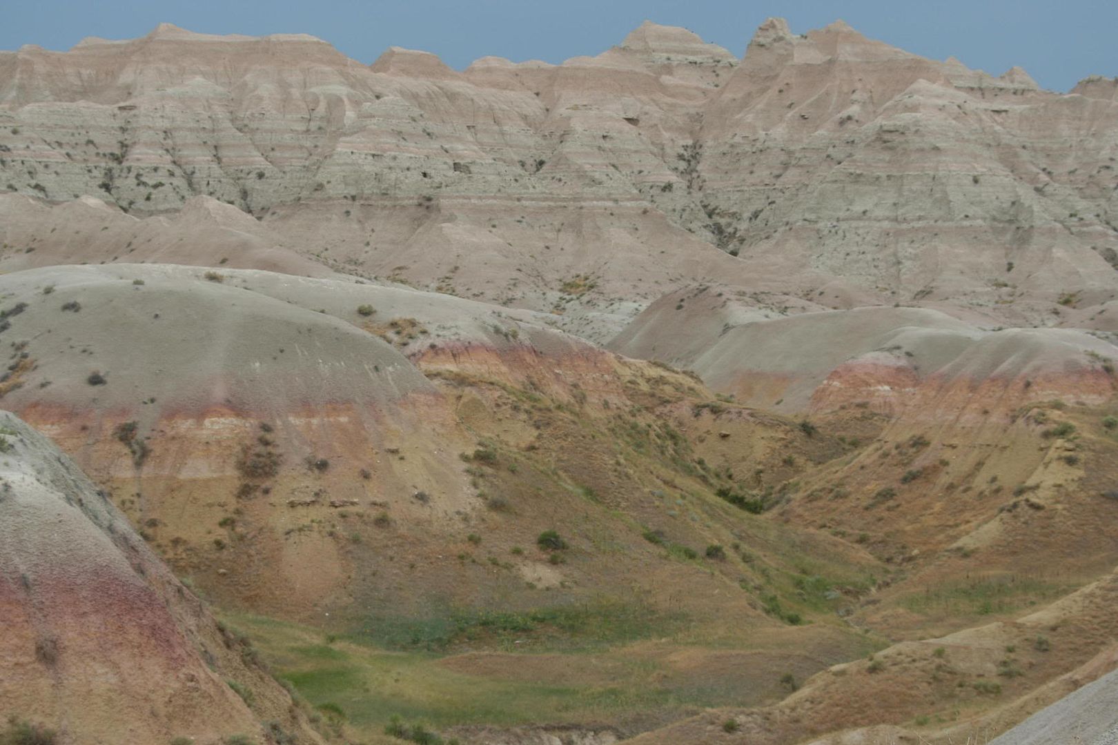
We happily left the hot, dry, eerie feeling Badlands today. This is a photo of the badlands. We like it there, but then again we didn’t. It is a strange place. At the same time beautiful, yet strangely barren. It is difficult to describe how the place makes you feel.

As we entered into the Black Hills where Custer State Park is we felt smiles coming to our faces. The hills really do appear black from afar. They are green grasses and darker green pines interspersed. Really beautiful! I think I love mountains because whenever I see them I always smile.

We stopped for gas while still in or near the Badlands in a little town called Scenic. What a weird little place. The buildings were from the early 1900’s, and looked it. The people seemed odd. The gas station didn’t even take credit cards, and they only had premium gas for $3.21 per gallon! Yikes. We put in 40 bucks and got out. Rod kept mentioning the movie The Hills Have Eyes. I’ve never seen it, but apparently it is a scary one, and the place must have reminded him of the movie…

We also stopped to wash the car and part of the trailer. Yeah! It needed a wash badly. The Badlands will do that to your car! About 3 minutes after washing the car in Rapid City, Brianna decided she had to go to the bathroom so bad… You know the drill, right. Why she couldn’t have realized this minutes earlier is beyond us. So, we pulled over to the side of the road and used the facilities in the RV.

We finally got here 2 hours and 20 minutes later, all to go just 105 miles! But boy is it gorgeous here! I won’t have any trouble staying here the 3 nights we are planning. Tonight we took a drive on the Wildlife Loop Road, where you can view native wildlife. It was amazing! We saw white-tailed deer, mule deer, pronghorn antelope, bunnies, turkey (6 toms), more pronghorn, and more, and more, and then a bison, and another. These animals were so close you could almost reach out of the car and touch some of them. The bison literally crossed the road mere feet in front of us! This is truly the land where the buffalo roam and the deer and the antelope play. We really did see some baby antelope running and playing and head butting.

On the technical side of things, the refrigerator is definitely not working properly. It continues to be way too hot in there, around 50 degrees in the refrigerator. I put the milk in the small cooler I have with me. Most of the food won’t go bad in there, but I am worried (thanks for making me a worry-wort grandma). We called a repair person today who was recommended by the camp host. He gave us a couple suggestions, but none have worked yet. We will call him again in the morning to see if he can come look at the unit. I have a bad feeling we are going to need to take the RV in and screw up our reservations. On the bright side, it’s not like we’re going to starve.

Tomorrow, Mount Rushmore!

July 7th Badlands National Park

Friday, July 7th, 2006
Day 12
Badlands National Park, South Dakota

Today was an adventurous day. After breakfast I went on a geology walk/talk with a park ranger. It’s like a class, but better. We learned about sod tables, clastic dikes and paleosols. A sod table is a raised flat area with sod or grass on it. It looks like a table. These form here in the Badlands due to erosion occurring faster on the sides of the formation than on the top, due to the vegetation slowing down the process on top. Thus a flat topped structure forms. A clastic dike is a vein of different rock running up and down the rock formation. It is harder than the surrounding rock and may stick out because it is eroding more slowly. These formed when the rock split and the crack filled in with different material, hardening over time to form new rock. Paleosols are fossil soils from millions of years ago. The ones we saw were reddish in color due to high iron content which oxidized (think rust). The rock actually looks like soil. I also saw some yellowish ones today on a drive we took.

At 10:30 the kids, accompanied by Rod, took an outdoor Junior Ranger class. They played some sort of game called rattles. I don’t really know how it went, because I wasn’t there, but the kids earned a second Junior Ranger Badge at the class.

After lunch we took a drive along the Badlands Loop Road, a scenic tour. We drove it to the intersection with the Sage Creek Rim Road, a dirt and gravel road and took that to Prairie Dog Town where there was a Ranger program. We learned about the Prairie Dogs and also saw some, in addition to a herd of Bison in the distance. Along the way there we also saw a large 10 point mule deer buck in velvet. He was busy peeing and when he was done he ran back to the one tree anywhere in sight and disappeared beneath it.

On the way back from our excursion we stopped at the Big Pig Dig, where they are excavating an ancient watering hole. They have found many fossils there, including the big pig, Archeotherium, also, Mesohippus, an ancestor of the modern horse, and a small hornless rhinocerous that I can’t remember the name of right now. There were severe thunderstorms just to our south and we had a spectacular display of lightning on the drive back. We also stopped to observe some pronghorn antelope. There may have been 8-10 of them.

Once back in camp we cranked up the A/C since the temperature was close to 100 degrees. At 4:30 I took the kids to the evening Junior Ranger program where they learned about Lewis and Clark and made a booklet, earning a third badge. The severe storm warning we had was for penny sized hail and 70 mph winds, but thankfully that missed us and it just rained a tiny bit. Phew. I though I was going to have to brace for a hurricane-like situation.

Currently it is10 pm and cooling down. We had a lovely sunset and saw a beautiful rainbow. We also observed 3 mule deer from our picnic table, but they were far away. It was neat to watch them through the binoculars. Rod is 8 for 8, having seen deer in every state so far! Today we had no mechanical issues, but I am concerned about the refrigerator. It is not keeping the food cold enough. The temp in there is around 50 degrees. The freezer is also out of the “safe” zone, but still below the freezing point. We are thinking it is just because it has been near 100 degrees and we are in the blazing sun. Hopefully nothing is wrong with the unit.

Tomorrow we’re off to Custer State Park!

Thursday, July 6, 2006
Day 11
Badlands National Park, South Dakota

Today we left the tiny town of Kennebec (population 284) for an even more remote area of South Dakota: The Badlands. This place is very different from anyplace I have ever seen. Rising out of the slightly hilly, dry grasslands and farms are these vast rock spires. It reminds me of a sand castle that is getting dried in the sun. As we drove into the park I felt as if I had been miniaturized and put into one of my kids sand castle creations.

It is quite windy here and very hot during the day. Today was 94 degrees and the wind was about 30 mph, steady. We are staying in the National Park campground, a primitive type with no electric hookup or water hookup. Even the dump station happens to be closed so we need to “dump” at our next stop. Fortunately we dumped before leaving the KOA this morning.

After setting up camp in the wind and unhooking the truck, we drove to the Visitor’s Center which was closed all last year for renovations and is now brand new and quite nice. There we watched a movie about the badlands (about 20 minutes long) in a nice clean air-conditioned theater. We browsed through the modern exhibits and went to the gift store. We bought Brianna and Sheldon their own National Parks Passports which they then were able to stamp and they also purchased a sticker from the park. These Passports are cool because the kids can bring them to each National Park we go to and get a stamp and buy a sticker if they wish.

Next we hiked the Notch trail which included a high ladder type staircase. It was fine going up, but coming down was pretty scary especially for the kids. But they did it. We didn’t make it to the “notch” because one area of the top of the trail was extremely dangerous in our opinion and we wouldn’t chance having the kids fall down the 200 foot high cliff. So, we turned back.

I hope when I upload this to the blog that I will be able to get some photos up too. I can’t tell you how difficult it was yesterday and this morning trying to get the photos up on the blog. The first 3 or 4 were easy, albeit slow. After that, Blogger wouldn’t take my photos for some reason. The KOA Ethernet was even extremely slow. Oh well, hopefully at the next KOA it will be faster.

We had some trouble with the generator today, but we decided that it was just way too hot keeping it on the front of the car on the cargo carrier, so we took it off and let it cool and it seemed fine. It ran and all, it just kept bogging and was registering that it was “overloaded” while running just the A/C and refrigerator. Anyway, all is well now and the temperature is dropping rapidly.

The kids did a ranger program today and earned a badge. They might do another one tomorrow. I am going for a ranger-led hike at 8:30 in the morning which will discuss the geology of this area. Rod is going to take the kids to a ranger program which may include a hike at 10:30 in the morning. Later tomorrow we plan to drive the “Badlands Loop Road” which is a scenic drive. Then perhaps we’ll here a ranger talk about the Prairie Dogs at the Prairie Dog Town. (The largest town in the Bandlands!)

Bye for now.

P.S. - We had fun crossing into Mountain Time and watching our clocks reset on our cell phones. Mine won!

Wednesday, July 05, 2006

July 5th, half way through South Dakota

Wednesday, July 5, 2006
Day 10
Drive half way through South Dakota

Today we woke up around 8 (not me, of course I’m always up way before everyone else) and made omelets in a new “camping” way. You take the eggs and put them into a ziplock bag. Then, squish them around and add whatever you want in your omelet. Squeeze out the excess air, seal, and place into boiling water for about 13 minutes. A perfect omelet comes out. REALLY tasty!

After breakfast we hiked about a mile and a half around the Mound (at Blue Mound State Park). It was very beautiful and somewhat hot. Rod showered when we returned and we left around noon for Kennebec, SD. We drove 205 miles in 3 hours and 25 minutes. We are staying overnight at a KOA, which is why I am finally able to post up my blogs. Unfortunately, the connection speed is very slow, so I am having a lot of trouble posting photos. I may have to do that at some other time.

This KOA is not that nice, but it will do. I did laundry and am online! Very cool! There is a pool. Brianna made a friend who is the same age as her. They traded addresses. Tomorrow we will be going to the Badlands. Hopefully we will get a campsite, since they are unreservable.

July 4th, Blue Mounds State Park, MN

Tuesday, July 4, 2006
Day 9
Drive to Blue Mounds State Park, Minnesota

Today was our longest day of driving. We drove from Wisconsin through most of southern Minnesota. We are about 2 exits from the South Dakota border. Today we drove 385 miles in less than 7 hours. It was pretty close to what I estimated it would be. We had a few interesting stops. The first was the SPAM museum in Austin, MN. That place was really cool, and I don’t even like SPAM. We even bought some SPAM there. Admission and parking were free, and the place was empty, I guess due to the holiday. A little while later we stopped at the 60-foot tall Jolly Green Giant statue in Blue Earth, MN. That was a really quick stop, but enough to take photos and stretch our legs.

Minnesota is a beautiful state with vast stretches of farmland unlike anything I’ve seen before. The fields are much larger than the ones in Indiana, Illinois, and Wisconsin. I was excited when we crossed the Mississippi River into Minnesota, but it was pretty anti-climactic. Rodney and I took turns driving today, since it was pretty much a “straight shot” on I-90. I’ve never seen so little traffic in my life, even on route 17 in upstate NY! Miles and miles of very few cars, with a mainly flat and straight road to travel on… easy driving!

Blue Mounds State Park is pretty deserted. We had to “self register” since there are no staff here and I was tempted to just drive to our pre-reserved site and skip the $7.00 vehicle fee, but didn’t. After a fast dinner of hamburgers and hotdogs, we walked over to the bison range to see the bison, and boy were there a lot of them! We also saw a deer out on the prairie, so now Rod has seen a deer (or more than one) in each and every state we have been in so far. We also saw a lot of bunnies out in the fields and paths we were on. By the time we got back to our campsite it was almost dark and we all sat outside and had our own little 4th of July celebration with the glow sticks that we had brought with us and the fiber optic light up things that I bought for the kids way back in May.

Brianna is a little sad that we couldn’t go see fireworks, but we did watch the Boston fireworks on television. She likes to do the “traditional” things that we always do, and this year is a little different. I told her to remember that this is a once in a lifetime trip and that she is very lucky to be able to do this, even if it isn’t what we “usually” do.

Tomorrow we are off to Kennebec, SD. It should only take us about 3 ½ hours, so we are going to go for a hike in the morning here at Blue Mounds. Hopefully we’ll see the cliffs and then head out. Tomorrow we’ll be at a KOA, and that is when I’ll post all these journals up on the blog and also do laundry…yuck!

July 3rd, Devil's Lake State Park


Monday, July 3, 2006
Day 8
Devil’s Lake State Park, Wisconsin

Today was an excellent day. We woke up early, well actually I woke up later than usual, but woke everyone else up earlier than usual. We drove down to the south shore of Devil’s Lake to hike the Balanced Rock trail, the Devil’s Doorway trail, and the Potholes trail. All were excellent! The Balanced Rock Trail was steep “natural” steps going up about 1000 feet. 0.4 mile never took me so long to hike before. The views were spectacular. My favorite site was probably Devil’s Doorway, which is like a stone doorway in the middle of the sky. I could picture the devil coming through it I suppose. The Potholes were just a few potholes in the rocks, and then it was a steep downhill climb for us. We felt great when we finished this challenging walk. One interesting thing we discovered on the way back on the flat trail near the parking lot was that there was a shaded area with a lot of “loose” boulders. It was noticeably cooler there when we walked by. We were hot and sweaty by this time, so we went to investigate further, and discovered that as we walked down this small depression to the rocky area it became quite cold. I would estimate it at around 50 degrees Fahrenheit. Just like walking into a cave, it was cold air coming from the rocky area. Very refreshing for weary, hot hikers!

When we returned I called Bill and he gave me directions to his house in Baraboo. We went there and then he and his wife took us out to lunch. What a lovely home they have! It was beautiful inside and out. We ate lunch at the Ho Chunk Nation Casino Buffet. It was a fascinating building and good food.

After lunch we drove through the Wisconsin Dells which is about five miles of water parks and other amusements. It looks like it belongs in Orlando or some such area, not in the Mid-West! It was very interesting but there sure was a lot of traffic there. Before lunch we toured around Baraboo. I learned a lot and was glad to have had such wonderful tourguides. Did you know that Ringling Bros. Circus started here?

After a lovely afternoon with Bill and Carla we said our goodbyes and headed up to play mini-golf near the campground. After a time I suddenly heard my name being called. Now that is unusual! I turned to see Bill and Carla in the parking lot of the mini-golf. They had thoughtfully picked up some “Cow Pies” for us and dropped them off. We had asked what they were because we kept seeing signs for them and then saw the store that sold them. They are a type of candy made right here in Baraboo. We were going to stop and buy some, but did not go past the store on the way from lunch. Bill remembered and got us what he thought we’d like. P.S. – They’re really good and I’ll bring some home for others to try. And they’re called Cow Pies, because, well, they look kind of like them…

We had a campfire tonight and made S’Mores again. Tomorrow we have our longest drive so we are trying to leave early. We’ll be off to Minnesota and attempting to cross most of it one day.